UN
66 School Lane
£ 196,500
Description
We don't have a Description for this property.
- Bedrooms
- 2
- Bathrooms
- 0

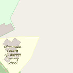

Leaflet © OpenStreetMap contributors
The heatmap indicates the level of crime in the area. The color of the heatmap indicates the crime severity and recency.
Metrics Year-on-Year
- Average area value
- 442,500.00 £Decreased by 34.44 %
- Average area rental value
- 1,643.00 £/moDecreased by 26.98 %
- Est rental Yield
- 4.46 %Increased by 11.50 %
- Crime Rate
- 0.00 %
from 675,000.00 £
from 2,250.00 £/mo
from 4.00 %
from 0.00 %
Nearby Schools
| Name | Type | Ofsted | Distance |
|---|---|---|---|
| Kilmersdon Church Of England Primary School | Voluntary Aided School | Good | 0.13 KM |
| Mendip Studio School | Studio Schools | Good | 1.90 KM |
| Writhlington School | Academy Converter | Requires improvement | 2.01 KM |
| St Nicholas Church School | Academy Converter | 2.04 KM | |
| Radstock Children'S Centre | Children's Centre | 2.21 KM |
Images
Nearby Streets
| Name | Average Price | Average Sqft | Distance |
|---|---|---|---|
| Kilmersdon Hill | £ 0 | 0 | 0.00 KM |
| Church Street | £ 1,295,000 | 0 | 0.00 KM |
| Manor Close | £ 425,000 | 0 | 0.00 KM |
| Charity Lane | £ 812,500 | 0 | 0.00 KM |
Nearby Listings
| Address | Price | Type | Score | Distance |
|---|---|---|---|---|
| School Lane, Kilmersdon, Somerset, BA3 | £ 1,250,000 | BUY | Unknown | 0.01 KM |
| Kilmersdon, Kilmersdon, Radstock, BA3 | £ 150,000 | BUY | Unknown | 0.38 KM |
| Silver Street, Kilmersdon, Radstock, Somerset, BA3 | £ 1,250,000 | BUY | Unknown | 0.46 KM |
| South View, Babington | £ 315,000 | BUY | 6 / 10 | 1.11 KM |
| Haydon Gate, Haydon, | £ 299,950 | BUY | 6 / 10 | 1.42 KM |
Nearby Properties
| Address | Price | Distance |
|---|---|---|
| 66 School Lane | £ 196,500 | 0.00 KM |
| Knoll House | £ 250,000 | 0.00 KM |
| The Limes | £ 570,000 | 0.30 KM |
| Shutes End | £ 435,000 | 0.30 KM |
| The Byres | £ 500,000 | 0.33 KM |